Xenios
The Project
An integrated application platform to protect and promote cultural and tourist sites.
The XENIOS project aims to develop services for the short, medium, and long-term forecast of extreme natural phenomena and natural disasters in sites of tourist and cultural interest, which are also vulnerable to natural hazards. The ultimate objective is to contribute towards a more effective management and mitigation of these risks.
In addition, the project aspires to enhance safety and improve the tourism product at these sites, through a mobile app which will offer visitors prompt and reliable information.
Summary
Tourism is a key sector driving economic growth in Greece. Thus, it deserves maximum attention and investment of effort for offering a high-class tourist product to visitors, who need to feel safe and relaxed during their visit or stay. A positive experience for tourists starts with the characteristics of the site they are visiting, be it archeological, cultural, environmentally unique, entertaining, etc. However, they also need to feel that attention is being paid to them and their well-being. This attention includes provision of relevant information on the elements of the site that are of interest to them and a feeling that they are safe.
The XENIOS project combines the increase of safety with the improvement of the tourist product in these areas, through a mobile app that provides timely and reliable information to visitors.
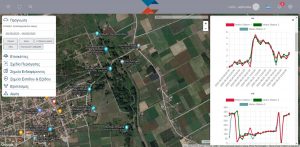
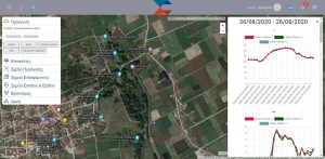
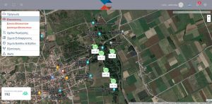
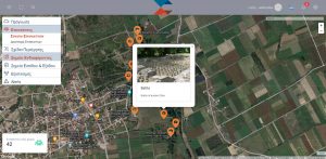
Depending on the nature of the information, forecasts are designed to be available in the form of intelligible maps, alerts or brief reports, through an online application and mobile app, which have been designed according to the needs of the different end-user categories. The XENIOS system—that hosts these services—operates interactively throughout all risk management levels, from the local (cultural/tourist site) to the regional and national ones, exchanging information and knowledge with real-time status reports and updates. To develop these services, satellite, meteorological, field, and aerial data are processed and analyzed intelligently, in order to provide predictions in different spatial and temporal scales. The experience and expertise of the collaborating research and business partners ensures both a timely planning and a sound implementation of the services and final platform. Finally, all opportunities for commercial exploitation of the platform are being thoroughly investigated via the composition of a comprehensive business plan.
Objectives
XENIOS proposes solutions for the:
provision of comprehensive and timely information to the competent site management bodies;
support of these bodies in employing different means for protecting both the visitors and the surrounding area from natural events and disasters. Communication with the visitors is achieved through a mobile application that also offers rich tourist content.
Project Capabilities
1.
Online map of different natural hazards’ danger forecast for tourist and cultural sites, at multiple spatial and temporal scales, provided to authorized authorities and organizations (e.g., Hellenic National Tourism Organisation, Hellenic Ministry of Culture and Sports, General Secretariat for Civil Protection, etc.).
2.
Ability to simulate the spatial behavior of fire at a local level, in order to prepare and adopt the necessary protection measures for the site and its visitors.
3.
Detection of precursor events that occasionally increase risk (e.g., increased visitors’ number at high-risk locations).
4.
Smartphone app to continuously monitor the number and dispersion of visitors at the site, which also informs them of points of interest and sends them warnings and instructions in case of an emergency or problem.
5.
Call center, through which the site manager may receive emergency calls from visitors, identifying the caller’s location at the same time.
The services provided by Xenios are:
1. Natural hazard forecasting
The natural hazard forecast within Xenios aims to timely inform field operators regarding the possible occurrence of phenomena that could cause disasters and endanger site visitors and staff. The forecast is achieved by:
- The recognition, in advance, of the conditions that can cause disasters due to a natural phenomenon (e.g. fire, flood, avalanche, earthquake, etc.) and the thresholds that, when exceeded, pose a danger
- The continuous forecasting and / or monitoring of the evolution of the factors that affect the occurrence of the phenomenon (e.g. wind, relative humidity, rainfall, snowfall, occurrence of aftershocks, etc.),
- The prediction, usually by using models or empirical rules, of the characteristics of the occurrence of the phenomenon (e.g. fire intensity, amount of water flow, etc.)
2. Natural hazard alert reporter
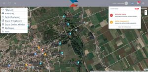
The mobilization (alarm) if it is foreseen to exceed the safety limits.
- This service aims to inform site visitors about the impending danger and how to stay safe. To activate this service:
-
- The first issue is the identification of the impending risk as the limits are expected to be exceeded
- The second is the decision to sound the alarm (maximum alert)
- The third is the immediate information of all the required according to the plan stakeholders (e.g. site manager, staff, head office, Civil protection authorities in the county and region, Fire Brigade, Police, etc.)
- The activation follows:
- Continuous monitoring of the development of potential risk
- Emergency alerting of visitors via XENIOS mobile application: the notification can be activated immediately after the aforementioned mobilization or at a later time, depending on the current conditions and their assessment
- Real time updates of the impending danger to all, while providing relevant instructions on what each visitor must do to stay safe
3. Site management featuring a call centre system
- The Xenios system has the ability to generally determine the location of the visitor in a space, if he has allowed it through the application settings on their mobile device. This allows site management executives to monitor the flow, and the densities of visitors, while utilizing a software tool case to manage security issues e.g. dispatching extra security and assistance staff where needed.
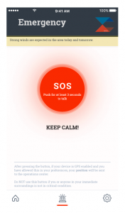
- At the same time, Xenios offers a call center function, through which two-way communication with visitors is ensured. Visitors are able, with the push of a button on the application screen (distress signal), to call for help due to an urgent personal issue (e.g. medical). In the event of insufficient access to the internet while being on site, the visitor can always call the land line of the Xenios management center and talk to a representative
4. Visitors’ attraction guide
As mobile phone ownership is widespread nowadays, this device is an obvious way to ensure communication between site administrators and visitors. Thus, Xenios offers a mobile phone application for this purpose, while enhancing the visibility of the site to visitors. If a visitor installs the free application and allows the use of location, then the XENIOS system by monitoring and evaluating the user’s position in the space, provides free informational material (digital tour, photos, videos, etc.) with rich tourist content, which concerns the sites and other characteristic points of interest of the routes that are being visited (texts, photos, videos, etc.).
The monument depicted above in Dion are under the responsibility of the Ephorate of Antiquities of Pieria, Hellenic Ministry of Culture and Sports/ Archaeological Resources Fund and the rights of the depicted monuments belong to the Ministry of Culture and Sports (Law 3028/2002).
Partners
From our blog
Read more on the Xenios project official website.

This research has been co-financed by the European Union and Greek national funds through the Operational Program Competitiveness, Entrepreneurship, and Innovation, under the call RESEARCH–CREATE–INNOVATE (project acronym: XENIOS, project code: T1EDK- 02219).


